WorldPop Projects
High resolution gender-disaggregated mapping of literacy
Contact people: Andy Tatem, Claudio Bosco
Collaborators/funders: UN Foundation, Data2x program
The Millennium Development Goals (MDGs) and the Sustainable Development Goals (SDGs) stimulated a rapid expansion in approaches to derive metrics for measuring progress toward their achievement. To take into account the high degrees of spatial heterogeneity across countries, sophisticated cartographic techniques were developed for mapping and modelling health and development indicators. Realizing gender equality will make a crucial contribution to progress across all the goals. The achievement of full human potential and of sustainable development is not possible if full human rights and opportunities are denied to many women all over the world.
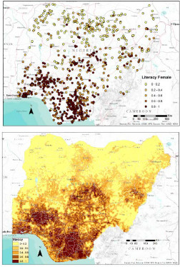
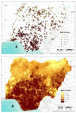
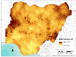
Demographic and Health surveys (DHS) data regarding the rate of literacy in people age 15-49 were used to predict high spatial resolution gender disaggregated maps, at unsampled locations in Nigeria, Kenya, Tanzania and Bangladesh, using predictive modelling techniques. Geostatistical models (machine learning and Bayesian geostatistical techniques) were used to produce detailed maps of literacy, taking advantage of the fact that literacy shows strong correlations with environmental and sociological factors, many of which are available nowadays as gridded spatial datasets. The outputs consist of high-resolution maps (1×1 km) of the proportions of women and men that are literate, together with estimates of mapping uncertainty. Quantifying the impact of gender disaggregated literacy rate in low- or medium-low- income countries is crucial to adequately inform policy- makers and decision- makers in order to promote any initiative that aims to make advances towards increasing the number of literate people and achieving gender equality.


